
09-06-2007 09:25 | Estofex | m.b.t. 09-06-2007 t/m 10-06-2007
Forecast Update
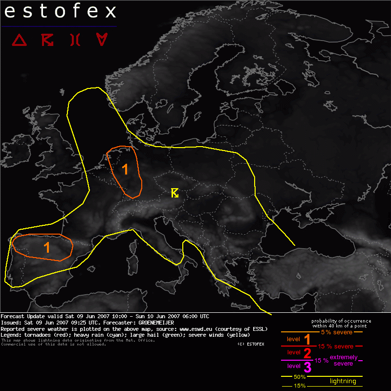
Valid: Sat 09 Jun 2007 10:00 to Sun 10 Jun 2007 06:00 UTC
Issued: Sat 09 Jun 2007 09:25
Forecaster: GROENEMEIJER
SYNOPSIS
Refer to convective forecast...
DISCUSSION
Have shifted the level 1 area over Benelux and Germany a little to the northeast, as the strongest thunderstorms are likely in the vicinity of the convergence Line that stretches roughly from Groningen to Cologne to Stuttgart. The sounding of Emden of 00Z suggests that with expected temperatures/dewpoints of 30/19 C
2000 J/kg MLCAPE could well form again, increasing the risk of large hail, torrential rains and wet downbursts despite deep-layer shear being weak.
Hagel(-schade) | Onweer/blikseminslag | Verwachtingen/waarschuwingen | Wateroverlast/(zware) neerslag | Wind/storm (-schade)
