Login om alle berichten te zien.
RP ONLINE User-Videos: So heftig tobte das Unwetter über NRW
30-05-2018 22:00 - YouTube - Relevant 30-05-2018

Code oranje voor onweersbuien op 29 mei 2018
30-05-2018 12:00 - KNMI - Relevant 29-05-2018
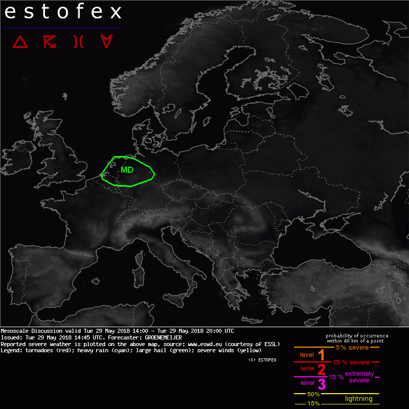
Mesoscale Discussion Valid Tue 29 May 2018 14:00 to Tue 29 May 2018 20:00UTC
29-05-2018 14:45 - Estofex - Relevant 29-05-2018
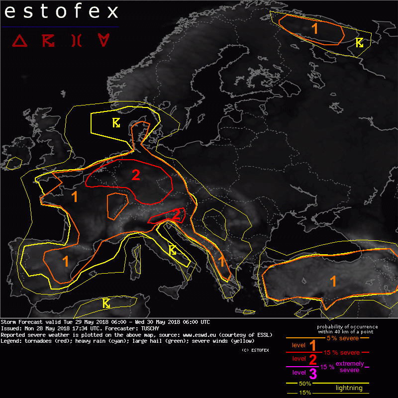
Storm Forecast valid: Tue 29 May 2018 06:00 to Wed 30 May 2018 06:00UTC
28-05-2018 17:34 - Estofex - Relevant 29-05-2018/30-05-2018
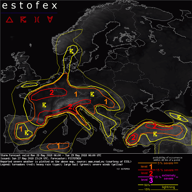
Storm Forecast valid: Mon 28 May 2018 06:00 to Tue 29 May 2018 06:00UTC
27-05-2018 23:24 - Estofex - Relevant 28-05-2018/29-05-2018