
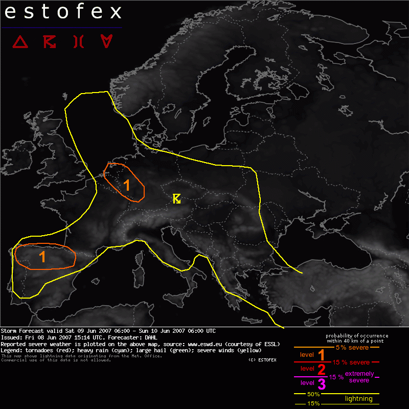
Storm Forecast Valid: Sat 09 Jun 2007 06:00 to Sun 10 Jun 2007 06:00 UTC
08-06-2007 | Estofex | m.b.t. 09-06-2007 t/m 10-06-2007
Level-1 over o.a. zuidelijke helft NL i.v.m. kans op grote hagel en zware windstoten.
Storm Forecast
Valid: Sat 09 Jun 2007 06:00 to Sun 10 Jun 2007 06:00 UTC
Issued: Fri 08 Jun 2007 15:14
Forecaster: DAHL
SYNOPSIS
Omega upper flow pattern is establishing over Europe ... with one quite intense, quasi-stationary upper
low affecting the western Iberian peninsula and the other one over the Balkans. Small upper low is present over N France and the Benelux countries, which will make slow southeastward progress, reaching southern Germany at the end of the forecast period. Except for a few weak mesoscale low-pressure systems, the strongest one of which will be present over Germany, NE France and the Benelux countries, synoptically quiescent conditions prevail over central Europe. Weak SFC high will remain in place over the Norwegian Sea.
DISCUSSION
... Benelux countries ... western Germany ...
Ample CAPE with afternoon values on the order of 1500 J/kg will likely be in place again over the Benelux States and western/central Germany. Though deep-layer shear will be somewhat marginal with only 10 to 15 m/s, storms may evolve into intense multicells capable of large hail and strong outflow winds reaching severe limits.
Hagel(-schade) | Onweer/blikseminslag | Verwachtingen/waarschuwingen | Wind/storm (-schade)