
Storm Forecast valid: Thu 16 Jun 2016 06:00 to Fri 17 Jun 2016 06:00UTC
16-06-2016 | Estofex | m.b.t. 16-06-2016 t/m 17-06-2016
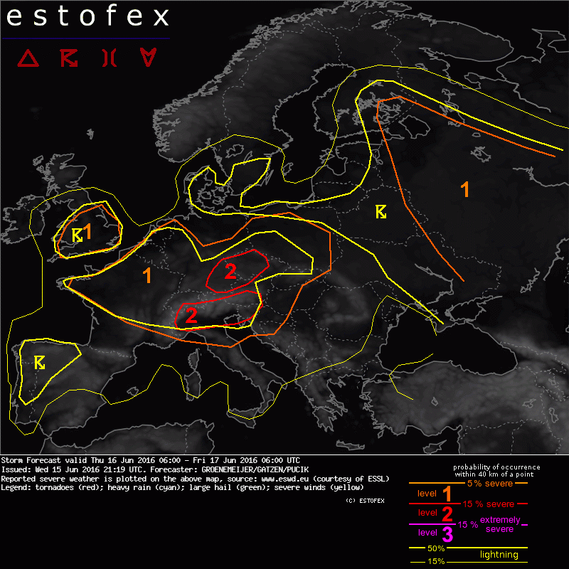
A level 1 was also issued for north and central France, much of the Benelux countries and much of Germany. The main risk across these areas is localized heavy rainfall.
Storm Forecast
Valid: Thu 16 Jun 2016 06:00 to Fri 17 Jun 2016 06:00 UTC
Issued: Wed 15 Jun 2016 21:19
Forecaster: GROENEMEIJER/GATZEN/PUCIK
A level 1 was also issued for north and central France, much of the Benelux countries and much of Germany. The main risk across these areas is localized heavy rainfall.
SYNOPSIS...
An unseasonably strong southwest flow is present between an amplified longwave trough over Iberia and a ridge over the Balkans. A shortwave trough embedded within the flow is forecast to approach the Alps during the day. Large-scale upward motion should affect the level 2 area, which should lead to slightly steeping lapse rates, exceptionally strong deep-layer shear, and storm initiation in a number of regions. Strong surface cyclogenesis is expected to occur during the latter half of the period across SE Germany and later the Czech Republic and the German/Polish border region.
Benelux, western Germany, France, and Britain...
Weak shear and weak flow, and rather low CAPE, but moist vertical profiles suggest that a risk of localized heavy rainfall will exist as diurnal convection develops. An isolated non-mesocyclonic tornado cannot be ruled out.
(Alleen de voor NL en direct aangrenzende gebieden relevante tekstdelen overgenomen, klik hier voor de volledige forecast, red.)
Onweer/blikseminslag | Verwachtingen/waarschuwingen | Wateroverlast/(zware) neerslag