
Guidance en weerkaarten per 08:00lt
04-07-2018 05:49 - KNMI - Relevant 04-07-2018/05-07-2018

Toekomstige zomers mogelijk droger dan gedacht
03-07-2018 12:00 - KNMI - Relevant 03-07-2018
Radars waarschuwen voor extreem weer
03-07-2018 12:00 - KNMI - Relevant 03-07-2018
Korte animatie waargenomen ontladingen+stijgstroom supercell 30/8/15 22:00
30-06-2018 19:30 - Skywarn NL waarnemer - Relevant 30-08-2015
Juni in top 10 droogste junimaanden
29-06-2018 12:00 - KNMI - Relevant 01-06-2018/30-06-2018
Aa en Maas: Onttrekkingsverbod uit oppervlaktewater
28-06-2018 12:00 - Waterschappen - Relevant 28-06-2018
Droogte uit recordjaar 1976 komt in beeld
22-06-2018 12:00 - YouTube - Relevant 22-06-2018

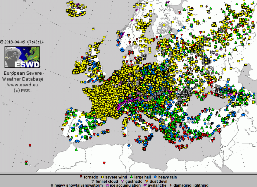
ESSL Jaaroverzicht 2017
01-06-2018 12:00 - European Severe Storms Laboratory (ESSL) - Relevant 01-06-2018
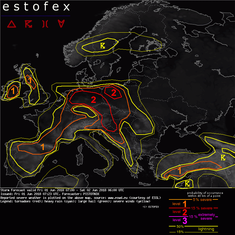
Storm Forecast valid: Fri 01 Jun 2018 07:00 to Sat 02 Jun 2018 06:00UTC
01-06-2018 07:23 - Estofex - Relevant 01-06-2018/02-06-2018
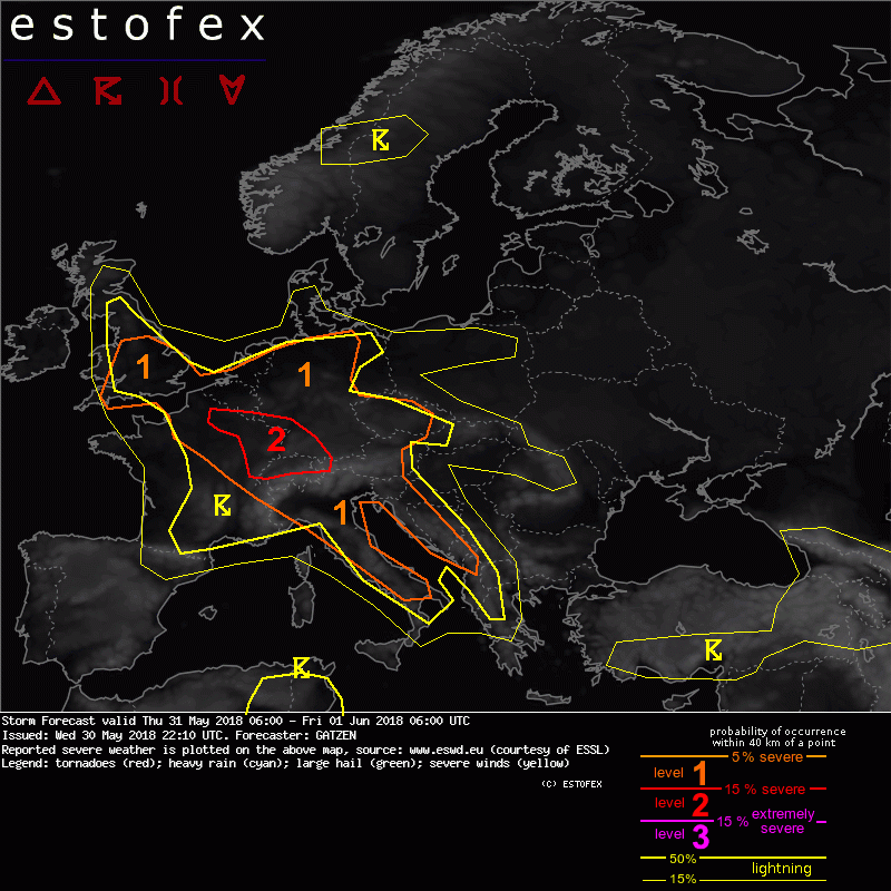
Storm Forecast valid: Thu 31 May 2018 06:00 to Fri 01 Jun 2018 06:00UTC
30-05-2018 22:10 - Estofex - Relevant 31-05-2018/01-06-2018
RP ONLINE User-Videos: So heftig tobte das Unwetter über NRW
30-05-2018 22:00 - YouTube - Relevant 30-05-2018

Code oranje voor onweersbuien op 29 mei 2018
30-05-2018 12:00 - KNMI - Relevant 29-05-2018
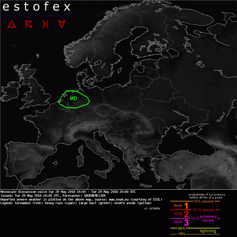
Mesoscale Discussion Valid Tue 29 May 2018 14:00 to Tue 29 May 2018 20:00UTC
29-05-2018 14:45 - Estofex - Relevant 29-05-2018
Een van de eerste zware buien van gisteren in beeld
28-05-2018 18:00 - Hans' Weerweb - Relevant 27-05-2018

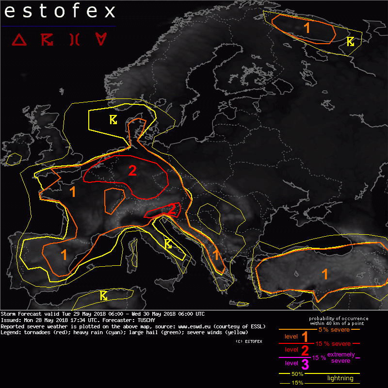
Storm Forecast valid: Tue 29 May 2018 06:00 to Wed 30 May 2018 06:00UTC
28-05-2018 17:34 - Estofex - Relevant 29-05-2018/30-05-2018
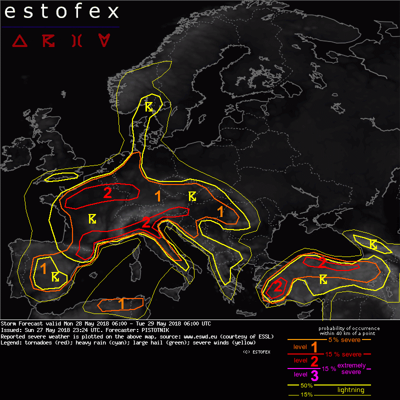
Storm Forecast valid: Mon 28 May 2018 06:00 to Tue 29 May 2018 06:00UTC
27-05-2018 23:24 - Estofex - Relevant 28-05-2018/29-05-2018
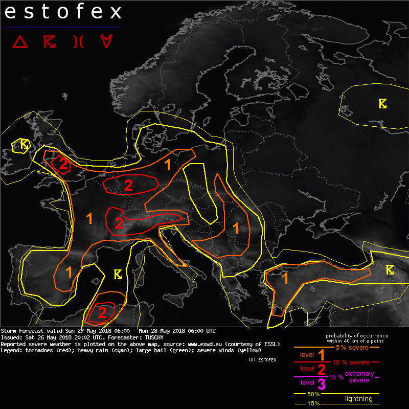
Storm Forecast valid Sun 27 May 2018 06:00 to Mon 28 May 2018 06:00UTC
26-05-2018 20:02 - Estofex - Relevant 27-05-2018/28-05-2018
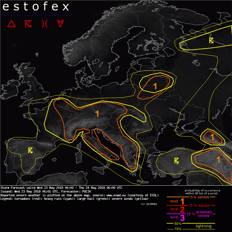
Storm Forecast valid: Wed 23 May 2018 06:00 to Thu 24 May 2018 06:00UTC
23-05-2018 06:01 - Estofex - Relevant 23-05-2018/24-05-2018
Storm Forecast valid: Tue 22 May 2018 06:00 to Wed 23 May 2018 06:00UTC
21-05-2018 22:18 - Estofex - Relevant 22-05-2018/23-05-2018

Bij toeval windsnelheid gemeten in Tornado Viersen (223 km/u)
17-05-2018 10:56 - Weerwoord - Relevant 16-05-2018