
15-06-2007 14:17 | Estofex | m.b.t. 16-06-2007 t/m 17-06-2007
Storm Forecast
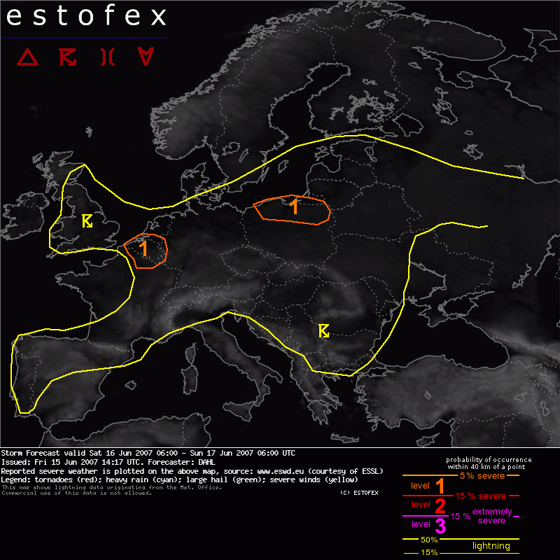
Valid: Sat 16 Jun 2007 06:00 to Sun 17 Jun 2007 06:00 UTC
Issued: Fri 15 Jun 2007 14:17
Forecaster: DAHL
SYNOPSIS
Rather intense upper low will move from the British Isles across the North Sea, while next/upstream Atlantic upper trough will reach the Iberian Peninsula late in the period. Weak surface lows will accompany these features while largely quiescent conditions persist over the rest of Europe.
DISCUSSION
... N Poland ...
It seems that the warm-sector air mass over Poland will become moderately unstable during the day. Mixed-layer moisture will likely not be too high so that MLCAPE should largely be in the 500 to 1000 J/kg range. However, Friday's 12Z ascent from Wroclaw (western Poland) did feature rich boundary-layer moisture and a MLCAPE of 2300 J/kg, which may be in place locally on Saturday as well. However, shear profiles are simulated to remain quite weak with less than 10 m/s deep shear. However, GFS 06Z does advertise 7 m/s 0-1 km shear, which may be marginally supportive of brief mesocyclones, especially where CAPE is large. Current thinking is that the majority of the storms will be poorly organized, though some better organized multicells and maybe also a few mesocyclones may occur, posing some threat for large hail and damaging wind gusts. If the suspected regions of large CAPE (2000 J/kg) coincide with the 7 m/s LLS region, an isolated tornado or two would also be possible.
... Belgium ... extreme N France ...
A small overlap of 10 m/s LLS and CAPE is simulated over N France and S Benelux in the late afternoon. It seems that the thermodynamic profiles will essentially be uncapped and quite moist, so that a slight chance for brief tornadoes seems to exist. However, minimal deep-layer shear should preclude long-lived mesocyclones and a more substantial severe weather threat.
... N Iberian Peninsula ...
Some thunderstorms may accompany the approach of the upper trough over the northwestern Iberian Peninsula in the late afternoon and evening hours. Deep-layer shear of 15 to 20 m/s and 10 m/s low-level shear should be sufficient for well-organized multicellular storms and supercells, capable of severe wind gusts, large hail, and a few tornadoes. However, confidence in widespread surface-based evolution remains rather low at the moment and a categorical risk is not issued. This may become necessary however, if convection becomes more widespread than currently anticipated.
Tornado/hoosverschijnsel(en) | Verwachtingen/waarschuwingen
