
08-04-2024 13:08 | Estofex | m.b.t. 08-04-2024
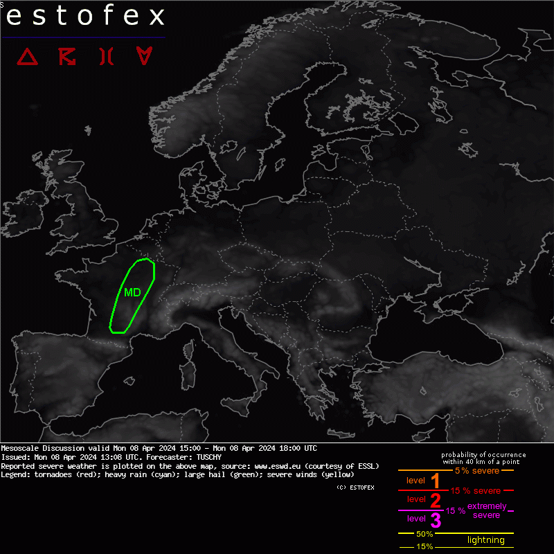
Mesoscale Discussion
Valid: Mon 08 Apr 2024 15:00 to Mon 08 Apr 2024 18:00 UTC
Issued: Mon 08 Apr 2024 13:08
Forecaster: TUSCHY
A MD was issued for parts of CNTRL into NE France. Validity does not match thunderstorm activity, which continues beyond our MD time stamp.
Lead wave (a bit faster than NWP guidance showed in the past) is about to clear France to the NE with abundant sunshine available in our MD area. WV loop supports this trend with the tightest WV gradient bound to the wave now over SE UK. Strongest forcing remains the approaching longwave trough from the W, which induces a constant uptick in background forcing during the evening/overnight hours.
Latest HRV indicates more aggitated Cu development atop/next to the Massif Central with sfc. T-Td spread in general staying around 10K (increasing/decreasing to the SE/N respectively). 12Z Nimes indicates a dry sub 700 hPa layer advecting N but this air mass should stay mainly E of the MD area.
The parameters remain supportive for organized DMC activity as somewhat steeper mid-level lapse rates shift atop a moist BL over CNTRL France with 400-800 J/kg MUCAPE forecast. Hodographs in this area feature impressive 0-3 km shear in the 15-20 m/s range with slightly stronger 0-6 km shear values. This vertical wind profile results in N/NE ward fanning downdraft precipitation which supports clustering betimes. However for the first couple of hours, discrete storms pose a large hail/severe to damaging wind gust threat with strong/long-lived mesocyclones. In addition an isolated tornado event cannot be ruled out with lowering LCLs to the N/NE.
Repeated isolated supercell development is forecast along the SE fringe of the evolving convective precipitation band but decreasing CAPE and the mentioned drier low-/mid-tropospheric air mass should support a downtrend in convective activity until noon.
Note there is a chance for a few supercells to exit this MD to the N/NE but this area will be covered by another MD in the near term.
Hagel(-schade) | Onweer/blikseminslag | Tornado/hoosverschijnsel(en) | Verwachtingen/waarschuwingen | Wind/storm (-schade)
