
08-04-2024 13:57 | Estofex | m.b.t. 08-04-2024
Mesoscale Discussion
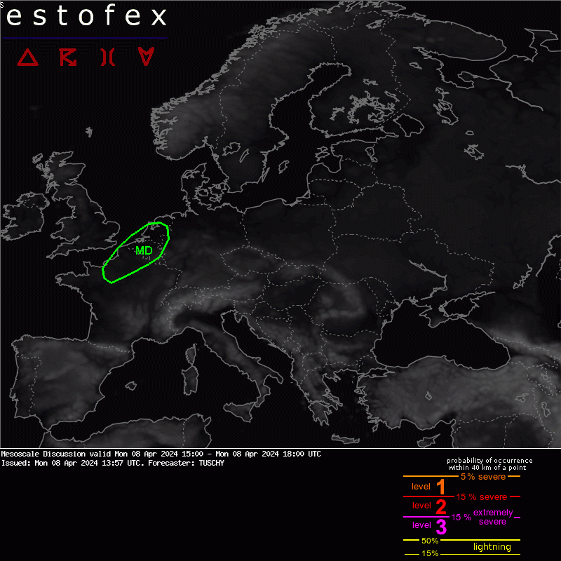
Valid: Mon 08 Apr 2024 15:00 to Mon 08 Apr 2024 18:00 UTC
Issued: Mon 08 Apr 2024 13:57
Forecaster: TUSCHY
A MD was issued for parts of NE France into Belgium/the Netherlands. Validity does not match thunderstorm activity, which continues beyond our MD time stamp. This MD also highlights an upgrade to a level 2 for far NE France into W/CNTRL Belgium .
As mentioned in the previous MD for CNTRL France, the lead wave cleared NE France to the NE with anticyclonic flow building in from the S. Hence the main uncertainty regarding background flow remains the source of forcing although this flow regime features ongoing weak upper divergence beneath a transient coupled jet configuration. Same for the Q vector fields, which show ongoing weak signals despite absent PV anomalies or stronger waves. Increasing thev resoluton of the height fields however indicates traversing weak waves although their influence on CI remains diffuse at best.
Weak WLA/frontogenesis next to the N-ward lifting warm front remain the main LL forcing for CI within the open warm sector, which remains weakly capped. Confidence in warm sector CI is very low right now.
The main focus for CI will be the eastbound moving cold front with good prefrontal diabatic heating. Dewpoints in the low to mid tens beneath a weak EML yield 400-1000 J/kg MUCAPE.
Kinematics along/ahead of this cold front stay impressive with elongated hodographs, offering 20/30 m/s 3/6 km shear. In addition, low LCLs in the sub-600 m range support intense SR flow in the lowest .5 to 1 km with lots of streamwiseness especially for deviating storms. Any surface based supercell will pose a tornado risk and a strong event is possible. Currently the highest tornado risk is forecast between E Basse-Normandie into W-Belgium until the evening hours, before decoupling from the BL begins. This area could see traversing maturing supercells in a very favorable environment and a level 2 upgrade becomes necessary.
Potential cloud debris from the activity further S could cause a regional downtrend in activity over E-Belgium but the more likely scenario is a growing supercell risk from the activity to the S, which builds into Belgium and later on into the Netherlands during the night. This activity should be more elevated with large hail and strong to isolated severe wind gusts the main risk (as some models support near surface based activity well into the night).
Hagel(-schade) | Onweer/blikseminslag | Tornado/hoosverschijnsel(en) | Verwachtingen/waarschuwingen | Wind/storm (-schade)
